|
|
www.avrosys.nu -
Copyright-free
Scandinavian Archive Prints |
|
|
|
||
|
|
||
|
|
||
|
|
||
|
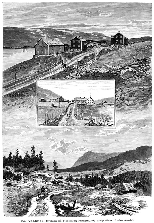
Valdres - Nystuen at Filefjell,
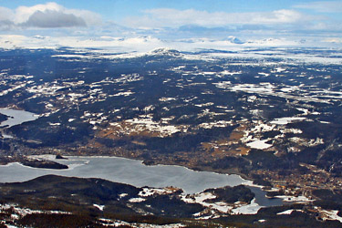
Frydenlund, view of Northern Aurdal. Artist: H. C. Olsen. Woodcut from 1882. Filefjell is a mountainous area between Lærdal and Valdres. It is the historical, as well as modern, main route, linking West Norway and Østlandet (”East County”). Filefjell, sometimes spelled Fillefjell, borders in the north to Jotunheimen. To the south it meets the Buskerud border. The European route E 16 crosses the mountain and reaches its highest point at Varden (1013 m). The road follows a valley through the mountainous area, and because of this is somewhat protected from the fierce weather of the Norwegian winter. The road is rarely closed due to wind or snow, making it the most reliable of the mountain passes in Norway. On both sides of the valley the terrain climbs steeply up to plateaus, with rolling hills and numerous lakes at about 1300 m. The highest peak in the area is Sulefjellet (1812 m). People have lived at Filefjell since the Stone Age. Smedalen is the main valley. The name means “The Smith Valley”. Iron production started here in the Iron Age. Burial Mounds from the same period are also found. Kongevegen (The Kings Road) is the name of the old trail over Filefjell. Due to the sometimes wet and marshy land in the valley bottom, the old trail runs farther up in the hill than the modern asphalt-road does today. The road got official status as main road in the year 1791. Filefjell is nowadays used mostly for recreational activities. Fishing, hunting, hiking and skiing are popular. Several hotels are used by tourists who come to ski in the mountain or in the downhill skiing park. Nord-Aurdal is a municipality in Oppland Fylke (County). It is part of the traditional region of Valdres. The administrative centre is the village of Fagernes.The municipality has an airport (Fagernes Airport) at Leirin. In Nord-Aurdal, there is a well-known alpine skiing center, Valdres Alpinsenter. The highest point in Nord-Aurdal is Duptjernkampen (1325 m). About half of the municipality lies above the 900 metres level. Tisleifjorden and Aurdalsfjorden are large inland lakes that are located in Nord-Aurdal. Valdres Folkemuseum is located just outside Fagernes and has large collections of old houses, textiles, and music instruments. Below: Fagernes with the airport at Leirin to the right. Photo from 2007. Via Wikimedia Commons. |
|
|
 |
||
Order a scanning in large size (10445 x 15125 pixels) The woodcut, scanned in the very large size mentioned above is sold as a JPG-file for € 10 or $ 10. Mail me at henriksson@avrosys.nu. Ref. no 100779.
|
||
| © 2009 Lars Henriksson. Updated: 2009-05-22. | ||
|
Custom Search
|
||